Overlay of sketch CXXIX - Monroe Harbor to the Civic Center (original jpeg)
Overlay of sketch LXXXIX - Population and parks (original jpeg)
Overlay of sketch CIII - Plan of the city, showing the general system of boulevards and parks existing and proposed. (original jpeg)
Overlay of sketch CXI - Plan of the center of the city, showing the present street and boulevard system. (original jpeg)
Overlay of sketch LXIX - Diagram of a system of freight handling for land and water transportation, to be worked in conjunction with one another. (original jpeg)
Overlay of sketch LXXIII - Diagram of the city and surrounding country, showing railroad circuits, B, C, D, and E, which are, or may become, tangent to the inner circuit(A). (original jpeg)
Overlay of sketch LXXIV - Diagram of the city center, showing the general location of existing freight yards and railroad lines, the present tunnel, system and proposed circuit, and connections for all these services, running to the central clearing yards. (original jpeg)
Overlay of sketch LXXV - Diagram of the city, showing complete system of inner circuits. (original jpeg)
Overlay of sketch LXXX - Diagram of city center, showing the proposed arrangement of railroad passenger stations, the complete traction system, including rapid transit, subway, and elevated roads, and the circuit subway line. (original jpeg)
Overlay of sketch LXXXI - Railroad rights-of -way and properties in the center of city and the existing radial arteries. (original jpeg)
Overlay of sketch LXXXII - Diagram of general scheme of street circulation and parks in relation to the areas covered by industries and manufactures (red); the center of industries is indicated by a star and the railroad properties and lines are blue. (original jpeg)
Overlay of sketch XCI - Existing and (in red) proposed diagonal arteries. (original jpeg)
Overlay of sketch XL - General diagram of exterior highways encircling or radiating from the city. (original jpeg)
Overlay of sketch LXXXV - Plan of a complete system of street circulation and system of parks and playgrounds, presenting the city as an organism in which all the functions are related one another. (original jpeg)
Overlay of sketch LXXXVI - Plan of the street and boulevard system present and proposed. (original jpeg)
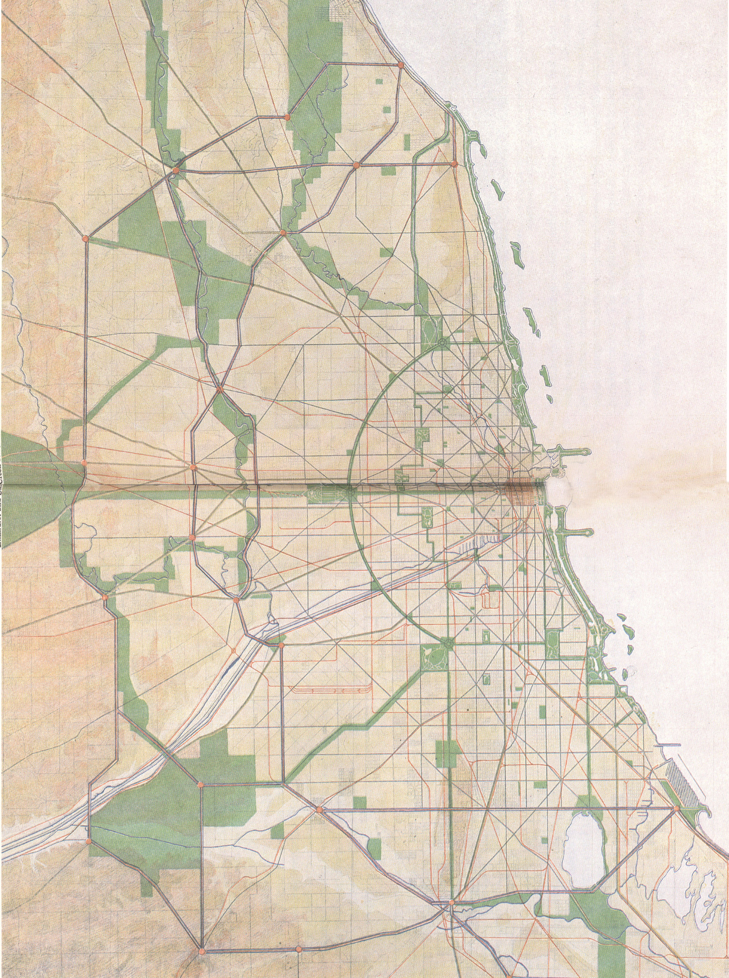
Overlay of sketch XLIV - General map showing topography, waterways, and complete system of streets, boulevards, parkways, and parks. (original jpeg)
Thanks to Tom Rajkovich, Franz Schulze, and Art Miller for their assistance with historical architecture in the creation of these models. Lori Boyer provided access to original sketches at the Art Institute of Chicago for which we are grateful.


